Latest Innovations in Google Satellite Maps


Intro
As the digital landscape continually evolves, Google Satellite Maps stands as a testament to how far we have come in geographical mapping and visualization. The sheer scale of information these maps can provide has opened up avenues not just for casual users looking to find a restaurant, but also for businesses, researchers, and urban planners aiming to extract actionable insights from geographical data. With advances in technology and machine learning, Google Satellite Maps have undergone significant enhancements, making them not only more accurate but also easier to navigate.
In this article, we will delve into the various facets of these advancements, exploring key improvements in functionality and user experience. We will also touch on the implications these tools hold across multiple industries, from agriculture to urban development. As we investigate these developments, we will also consider the ethical dimensions surrounding the use of such detailed geographical data, ensuring a comprehensive view of how Google Satellite Maps are shaping our understanding of the world.
So whether you are a tech-savvy individual wanting to stay ahead of the curve or a casual user curious about what makes these maps tick, there's something in this exploration for everyone.
Prolusion to Google Satellite Maps
In an era where geographical understanding holds significant sway over numerous sectors, Google Satellite Maps stands as a pivotal tool transforming the way we perceive our world. From planning urban spaces to monitoring climate changes, the application of satellite imagery extends far beyond a simple map. It allows for intricate analyses that blend precision with accessibility, addressing both everyday needs and specialized uses. With technological advancements steering its capabilities, users are privy to a treasure trove of features that elevate their experiences.
History and Development
The roots of Google Satellite Maps trace back to the early 2000s when the digital mapping landscape was still in its infancy. Google acquired Keyhole, a company specializing in satellite imaging, in 2004. This acquisition solidified their foothold in geographical data and laid a robust foundation for what would become an indispensable resource. The evolution has been remarkable—initially providing basic visualizations, the platform has taken leaps toward enhanced resolution and interactivity.
As innovations emerged, so did the capabilities of these maps. By 2005, Google launched Google Earth, a game changer that allowed users to explore 3D recreations of terrains and urban environments. Each update introduced new features, such as Street View in 2007, which integrated ground-level imagery into the fold. Today, a streamlined fusion of satellite views with user-generated content and real-time updates redefines our approach to navigation and locational awareness.
Current Technological Framework
At present, Google Satellite Maps operates on a framework that combines advanced satellite imaging technology with dynamic data processing. High-resolution imagery allows users to zoom into individual buildings or discern intricate details of natural landscapes. This fine-tuning is achieved through satellites equipped with sophisticated imaging systems capable of capturing data in various wavelengths.
Moreover, real-time integration of geographic information system (GIS) technologies enhances the mapping experience significantly. The marriage of artificial intelligence with satellite imaging has empowered the platform to analyze changing environments seamlessly. Predictive analytics, for instance, can project urban development trends or assess real-time environmental conditions.
The user interface has been refined to prioritize ease of use, ensuring that even those who are not tech-savvy can navigate with confidence. With personalized features, such as saving specific locations and creating tailored layers of information, Google Satellite Maps serves not just as a navigational tool but as a resource for education and planning in diverse fields.
"Understanding the terrain can shape the way policies are developed and decisions are made. Knowledge of geographic patterns derived from satellite maps is invaluable in today’s societal and environmental challenges."
In summary, the dual forces of historical evolution and contemporary technological advancements consolidate Google Satellite Maps' position as a leader in the field of geo-information. Its growth mirrors broader developments in data collection and visualization, ultimately reflecting a world that increasingly relies on geographic insights.
Features of the New Google Satellite Map
Understanding the features of the new Google Satellite Map is essential to appreciate the advancements it offers. These features not only enhance user experience but also redefine how geographical data can be interpreted and utilized across various fields. The benefits are immense, especially when you consider how crucial accurate satellite imagery has become in modern contexts like urban planning, environmental monitoring, and even among everyday users who need reliable maps for navigation.
High-Resolution Imagery
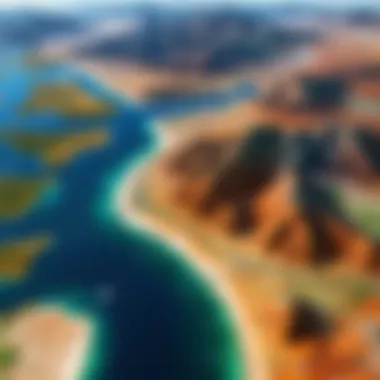
High-resolution imagery is one of the standout features of the latest Google Satellite Map. This advancement allows users to see details that were previously difficult to discern. Imagine trying to spot a park in your neighborhood; now, thanks to enhanced resolution, you can see benches and walking paths.
Users in various fields can utilize this improved resolution effectively. For example, urban planners can assess land use more accurately by observing the condition of infrastructure. Similarly, archaeologists might spot ancient structures that blends into the terrain. This vivid detail opens up avenues of exploration and functionality that were not as attainable before.
Furthermore, Google's shift towards higher pixel counts means that images can be zoomed in significantly without losing clarity. This is a game changer, shifting the focus from merely locating areas to analyzing specific features within those areas.
Real-Time Data Integration
Real-time data integration is another hallmark of the new Google Satellite Map that has significant implications for its users. In today's fast-paced world, having up-to-date information is crucial. This feature makes it easier for individuals and organizations to get the latest updates related to traffic, weather, and even natural disasters.
For instance, a commuter can view live traffic conditions before leaving for work, avoiding areas with heavy congestion. This feature is powered by a combination of data feeds from users and various external sources, essentially transforming the map into a dynamic tool.
Moreover, emergency services can use this data to improve their response times during disasters, like floods or hurricanes. This not only helps in saving lives but also in organizing aid in the community more efficiently.
User Interface Enhancements
An intuitive user interface makes navigating Google Satellite Maps a breeze. Recent enhancements have focused on simplifying how information is presented. This means that even tech novices can easily access advanced features without getting bogged down by technical jargon or convoluted pathways.
Improvements like customizable layers allow users to switch between viewing options – satellite imagery, terrain, or even street views – with just a click. This flexibility enhances how users interact with the information available, tailoring it to meet their specific needs.
Additionally, a more responsive design accommodates a range of devices, from smartphones to larger screens. This responsiveness ensures uniformity in experience across platforms, making it easy for users to access satellite maps anytime, anywhere.
"With the rise of technology, simplicity in access and navigation is paramount. Google Satellite Maps has effectively embraced this principle through its user-friendly enhancements."
Overall, the new features in Google Satellite Maps are poised to make a lasting impact. From high-resolution imagery to real-time data integration and intuitive user interface upgrades, these innovations are valuable for an array of industries as well as individuals.
Applications of Google Satellite Maps
The emergence of Google Satellite Maps has unleashed a multitude of possibilities across various fields, reshaping how professionals and enthusiasts alike interact with geographic data. The importance of this topic in the discussion about the latest developments in satellite mapping cannot be overstated. As society grapples with complex urbanization challenges and environmental issues, these satellite maps are becoming an indispensable tool in finding solutions.
Let’s delve into the specifics of how this technology is applied in key areas such as urban planning, environmental monitoring, and agriculture.
Urban Planning and Development
Urban planners face an uphill battle when it comes to addressing population growth and the resulting infrastructure demands. Google Satellite Maps provide a detailed aerial view that assists in identifying trends and layout designs for city expansion. By analyzing satellite imagery, planners can:
- Assess land use patterns effectively.
- Identify potential areas for green spaces or new construction.
- Evaluate the impact of proposed developments on existing communities.
The high-resolution imagery allows urban development experts to spot issues even before ground-breaking occurs, saving time and often considerable amounts of money. Additionally, the ability to overlay zoning maps on satellite images facilitates a clearer understanding of land use regulations and restrictions.
Environmental Monitoring
As global climate change accelerates, the need for thorough environmental monitoring has never been more crucial. Google Satellite Maps extend their reach into this realm through improved methodologies for data collection and analysis. With these maps, researchers and environmentalists can:
- Monitor deforestation and habitat degradation in real-time.
- Track weather patterns that impact ecological systems.
- Understand shifts in land use that might affect climate and biodiversity.
"The integration of satellite imagery in environmental research is no longer a luxury; it has become a necessity for informed decision-making."
This capability not only enhances our understanding of environmental changes but also enables timely interventions that may prevent or mitigate the impact of these changes. In this light, satellite maps emerge as both informative and transformative in environmental protection efforts.
Agricultural Insights
The agricultural sector has been significantly shaped by advancements in technology, and Google Satellite Maps play a crucial role in modern farming practices. By utilizing high-resolution images and real-time data, farmers can:
- Evaluate soil health and moisture content across vast fields.
- Optimize crop yields through precision farming techniques.
- Monitor crops for pests or diseases, thereby reducing the reliance on harmful pesticides.
Notably, satellite maps allow farmers to make data-driven decisions that can lead to more sustainable practices while boosting productivity. The insights drawn from satellite imagery prove crucial for food security, and the role they play positions technology at the forefront of agricultural innovation.
In summary, the applications of Google Satellite Maps span a wide spectrum of industries, offering profound insights and enhancing decision-making processes. As technology continues to evolve, these maps will undoubtedly play an increasingly pivotal role in shaping a more efficient and sustainable future.
Accessibility and Usability
In today’s world, where technological advancements frequently reshuffle the way we interact with digital resources, accessibility and usability have emerged as fundamental aspects of Google Satellite Maps. These considerations go far beyond simply making these maps available; they involve designing the tool so that it can be efficiently used by everyone, regardless of their technical prowess or physical ability. The importance of accessibility is especially pertinent in the realms of urban planning, education, and environmental monitoring, where informed decisions often hinge on the analysis of geographic data.
Device Compatibility
When discussing device compatibility, the wide array of platforms on which Google Satellite Maps can be accessed is noteworthy. Whether it’s a high-end computer, a tablet, or a mobile phone, users want a seamless experience. Responsive design plays a crucial role here, ensuring that maps are viewable and usable across diverse screen sizes and resolutions.
- Mobile users benefit from applications that adjust to their environment, while desktop users may take advantage of more powerful features and detailed views.
- Furthermore, Google has made strides in desktop applications, permitting easy navigation through various tools, like layers and markers, which enhance the experience.

This level of compatibility ensures that users have access to mapping tools at their fingertips, empowering them to make informed choices in real-time. With the integration of different operating systems, everyone from city planners to curious individuals can participate in geospatial analysis, regardless of their hardware setup.
User Engagement and Feedback
Monitoring user engagement through feedback mechanisms gives Google valuable insights into how people are navigating their satellite maps and what specific features resonate most. A user-friendly system encourages interaction and offers avenues for improvement based on user experiences. Feedback can be gathered through different channels such as:
- Surveys: Users can express their opinions regarding the usability of specific features.
- Comment sections: Forums or sections where users can voice their thoughts can also serve as a treasure trove of suggestions for enhancements.
- User analytics: Tracking patterns in navigation and popular features helps Google understand which aspects of the maps captivate users.
Engagement is more than just using the tool; it is about feeling a sense of attachment to the content and believing one's feedback can steer future developments. Improving the platform through user suggestions fosters a sense of community, emphasizing that software should evolve alongside its users’ needs.
Educational Uses in Schools
The educational sector stands to gain significantly from the accessibility of Google Satellite Maps, turning a virtual landscape into tangible learning experiences. Schools can harness the power of satellite imagery in various subjects:
- Geography: Students learn about topographical features, ecosystems, and climate interactions.
- History: Maps can reveal how urban sprawl has impacted historical landmarks and cultural sites.
- Environmental Science: Students can engage in real-world environmental studies by observing changes over time, such as deforestation or urbanization.
Furthermore, interactive classrooms connecting students with satellite technologies can inspire future generations to explore careers in GIS, environmental science, or urban development. By integrating real-time mapping into investigations, educators can foster critical thinking and analytical skills among students, enabling them to decipher the layers of information presented in geographic data.
In a world increasingly reliant on visual data, making satellite maps accessible and usable for educational purposes is essential to nurture informed citizens of tomorrow.
By prioritizing accessibility and usability, Google Satellite Maps not only enhances the user experience but also democratizes data, making it an essential resource in both everyday life and specialized fields.
Geospatial Analysis with Satellite Maps
Geospatial analysis has come forth as a key component in the understanding and utilization of Google Satellite Maps. This intersection of geography and technology allows for a deep exploration of spatial relationships and patterns in the data. As satellite imagery continues to improve in resolution and frequency, the importance of this analysis has only grown. Users, ranging from urban planners to environmentalists, leverage these insights to make informed decisions that impact both their immediate surroundings and broader contexts.
Understanding Geographic Patterns
To grasp the significance of geographic patterns, one must first recognize the nuances of spatial distribution. Google Satellite Maps provide layers of data that reveal not just locations but also the stories tied to those places. For instance, the mapping of poverty levels against green spaces can uncover inequalities hidden within urban environments. Each pixel tells a story, and analyzing these patterns paves the way for actionable insights.
- Identifying Trends: Geographic patterns can signal trends — both positive and negative. An increase in green areas in a city might indicate successful urban planning efforts.
- Resource Allocation: By understanding where certain patterns emerge, governments or organizations can allocate resources more effectively, ensuring support reaches the right areas.
- Disaster Preparedness: Patterns of historical events, like flooding or wildfires, offer lessons that can inform future preparedness strategies.
"Geospatial analysis with satellite imaging serves as a modern compass; correctly tuned, it guides us through the complexities of space and time, revealing truths that may not be immediately visible."
Impact on Research Methodologies
The advancement of Google Satellite Maps has extended far beyond casual navigation; it has transformed research methodologies across various disciplines. Researchers can now utilize satellite images for longitudinal studies, comparing data over time, revealing trends that are pivotal for understanding climate change, urban development, or even sociopolitical shifts.
- Quantitative Analysis: Satellite data provides extensive quantitative metrics that researchers can analyze. Measurements of tree cover density over the past decades might reveal trends in biodiversity or the effects of deforestation.
- Interdisciplinary Collaboration: It fosters collaboration among different fields. For example, ecologists can team up with urban planners to study the impact of urban sprawl on local ecosystems, all facilitated by shared geographic data.
- Enhanced Data Accuracy: With the integration of real-time data, research outcomes become more accurate, allowing scientists to refine their models and predictions. This can lead to better climate action strategies or improved urban designs.
In summary, geospatial analysis with Google Satellite Maps is not merely a tool for navigation; it is a complex system that unravels the intricate webs of interactions within our environment. As technology evolves, so too will the depths and breadths of these analyses, leading to innovations and insights that can change our approach to understanding the world.
Challenges and Limitations
While Google Satellite Maps provide breathtaking views of the Earth and have transformed how we navigate and analyze our surroundings, they come with their own set of challenges and limitations. Understanding these constraints is crucial for users who rely on these tools for accurate data, as well as for developers aiming to enhance functionality. The discussion around these challenges emphasizes the need for caution, critical thinking, and continued innovation in satellite mapping technology.
Data Privacy Concerns
One of the most pressing issues surrounding satellite imagery is data privacy. The accessibility of high-resolution images raises eyebrows because they can expose sensitive locations, from private residences to government facilities. Users may not fully grasp that their images might be captured and shared by someone else. This begs the question: how much personal space are we willing to sacrifice for convenience?
The potential misuse of this data can lead to dire consequences, ranging from invasion of privacy to even criminal activities. With such a vast amount of geographical information available, the risk of unmanned drones or unauthorized entities using satellite maps for ill intent is a palpable concern. In such a saturated digital landscape, it's essential for companies like Google to establish clear guidelines on image usage, ensuring users are informed about their data rights. The balance between innovation and privacy safeguards is delicate but essential in creating trust with users.
Technical Constraints
Technical limitations can also hinder the usability of Google Satellite Maps. Let's face it, not everyone possesses top-tier internet speeds or devices capable of handling intense graphical data. For instance, in remote areas where connectivity is spotty, loading high-res images can feel like watching paint dry.
Moreover, software capabilities play a significant role. Those newer features that wow users may not be seamlessly integrated across all platforms, leading to discrepancies in user experience. As a result, less tech-savvy individuals might find themselves losing interest or feeling overwhelmed by functionalities that don’t work as expected.
Addressing these technical constraints requires ongoing investment into optimizing software for a diverse range of devices, ensuring users have a smooth experience regardless of their gadget’s capabilities.
User Misinterpretation of Data
Another considerable hurdle is the risk of user misinterpretation of the data presented. Satellite imagery can sometimes tell a complex story. A casual observer might mistake a hunk of concrete as a new structure when in reality, it could be an industrial facility.
This misinterpretation can have dire implications in fields like urban planning or environmental monitoring. When communities fail to analyze data thoughtfully, poor decisions could cascade through projects, affecting countless lives.
To mitigate these risks, educational resources regarding interpretation should be readily available. Users must be armed with the knowledge to discern between what is real and what is merely an illusion of perspective. An informed user is crucial for leveraging the full potential of satellite mappings while minimizing potential misunderstanding.
In the vast realm of Google Satellite Maps, while the journey offers innovative capabilities and insights, it’s vital to navigate through its challenges mindfully.
Future of Google Satellite Maps
As we stand on the brink of a new era in digital cartography, the future of Google Satellite Maps appears more promising than ever. The rapid advancements in technology coupled with growing public interest in spatial awareness are propelling this tool into a range of applications that were once only dreams. The importance of understanding these developments cannot be overstated, as they hold significant benefits and considerations for various sectors, from urban planning to environmental monitoring.
Emerging Technologies
Among the many trends shaping the future of Google Satellite Maps are emerging technologies that redefine the boundaries of satellite imaging. Drones, for instance, are becoming more prevalent for fine-scale mapping tasks. These aerial vehicles, equipped with high-resolution cameras, complement the extensive data provided by traditional satellites. They address specific local requirements, like tracking changes in natural resources or infrastructure over short time frames, which satellites may miss due to their higher altitude and broader scope.
Another interesting development is the rise of hyperspectral imaging. Unlike standard satellite imagery that captures data across a few bands of light, hyperspectral cameras capture countless spectral bands, providing a more detailed analysis of land cover or vegetation health. This technology allows for an accurate assessment of agricultural fields, contributing valuable insights for farmers seeking to enhance yield productivity.
Moreover, the fusion of satellite data with Internet of Things (IoT) devices is a game-changer. For example, environmental sensors can gather local weather conditions, which can then be integrated with satellite images to produce real-time maps that reflect current conditions rather than historical data. This connection between ground realities and aerial perspectives strengthens our grasp of geographic phenomena.
Integration with AI and Machine Learning
Artificial Intelligence (AI) and machine learning are also making waves in the realm of satellite mapping. The ability of AI algorithms to analyze vast amounts of data quickly offers incredible potential for enhancing the functionality of Google Satellite Maps. With the integration of these technologies, Google is working to improve the accuracy and speed of image recognition. AI can decipher patterns within the data, making it easier to identify land use changes, track urban sprawl, and even detect natural disasters in their early stages.
Such developments lead to smarter maps capable of predicting changes based on historical data. For example, if a neighborhood shows signs of increased traffic congestion, AI can utilize previous data trends to anticipate future growth and recommend infrastructure improvements. This proactive approach allows city planners to make informed decisions before issues escalate.
Additionally, machine learning can facilitate user personalization. By learning from user behavior, Google Satellite Maps can tailor search results to wield more relevant geographic information based on the preferences and past interactions of each user.
A key point to note here is the implications of data ethics. With an increased reliance on AI comes the responsibility to respect user privacy and ensure data security. Striking the right balance between innovation and ethical considerations will be essential as these technologies continue to evolve.
"The future isn't something we enter. The future is something we create."
With these emerging technologies and the clear synergy with AI and machine learning, Google Satellite Maps stand to revolutionize how we perceive, interact with, and analyze our world. The developments on the horizon will not only enhance current functionalities but can also redefine our understanding of mapping, making it more intuitive and responsive.
Finale
In wrapping up our exploration of Google Satellite Maps, it becomes clear that the ongoing development of this technology holds significant weight for various sectors and geographies. These maps have transformed not just how we visualize the world, but also the very fabric of decision-making processes in industries ranging from urban planning to environmental conservation.
Summary of Key Insights
A few crucial points deserve emphasis as we conclude:
- Advanced Imaging Techniques: The integration of cutting-edge, high-resolution imagery ensures that users have access to some of the clearest, most up-to-date representations of the Earth’s surface available today. This improvement directly contributes to better analytics in fields like agriculture and urban design.
- Real-Time Data Connectivity: With constant updates and real-time data feeds, users can make informed decisions based on the latest geographical changes or developments. This capability is invaluable for sectors such as disaster management, where timely information can save lives.
- Enhanced Usability: Crafting an intuitive user interface has made satellite maps not just tools for professionals but easily accessible resources for everyone, including students and hobbyists. The effort to engage a diverse user base speaks volumes about Google's commitment to inclusivity.
Understanding these advances isn't just about technology for technology's sake. It’s about seeing how Google’s ongoing enhancements in satellite mapping are paving the way for a world where geospatial data not just meets needs but inspires breakthroughs in thinking and application.
Final Thoughts on Satellite Mapping
The future of satellite mapping, particularly through platforms like Google’s, shows immense promise. As we venture further into an age defined by data, satellite maps can help us not only see but comprehend and react to the happenings of our planet in real-time. However, with this power comes immense responsibility. Issues around data privacy and the potential for misinterpretation demand vigilant scrutiny.
"Maps are not just for navigation. They are for understanding our world in complex ways."


